Share

Luxor 2005-09

Luxor 2005-09

THE AVENUE OF SPHINXES & LUXOR GOLDEN TRIANGLE

احياء طريق الكباش وإعادة تخطيط المنطقة المثلثة المحصورة بينه وبين النيل  ومعبدى الأقصر والكرنك
“ما يسمى “المثلث الذهبى

FACTS & INFO

Year: 2005-09
Location: Luxor, Egypt
Project Area: 750 FD / 3.15 km2
Main Consultant: Archplan & Cube Consultants
Scope: Vision & Conceptual Planning
Client: Luxor Governorate / Dr. Samir Farag the Governor of Luxor
Visual updates: 2020


Project Summary

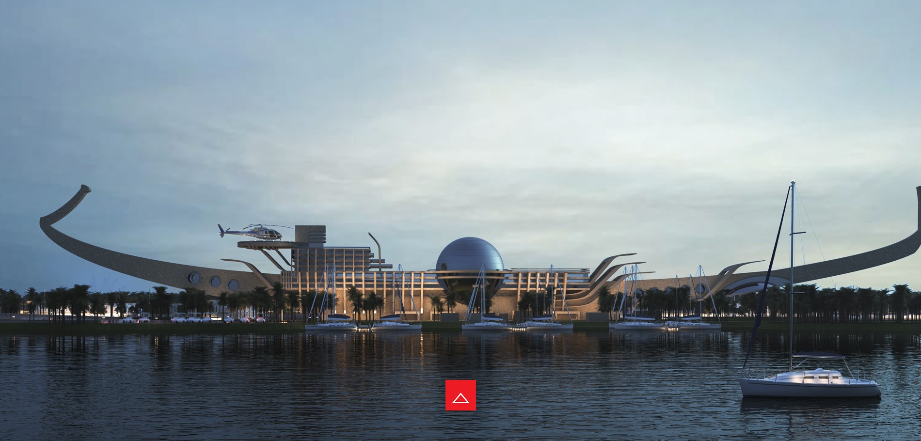
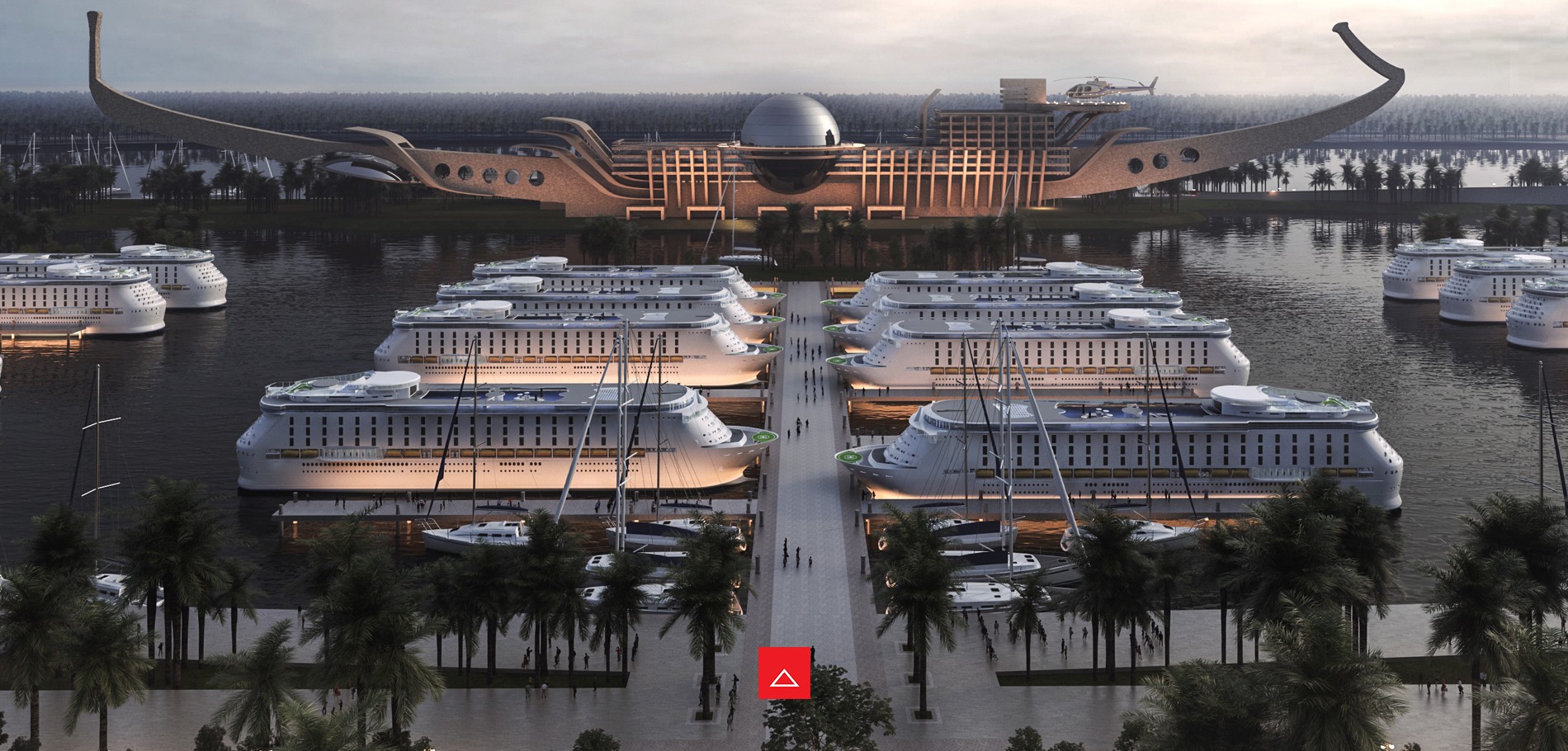
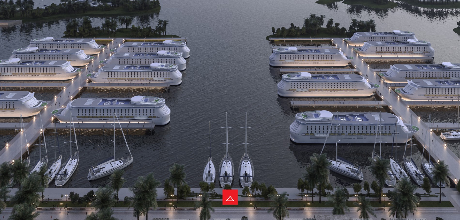
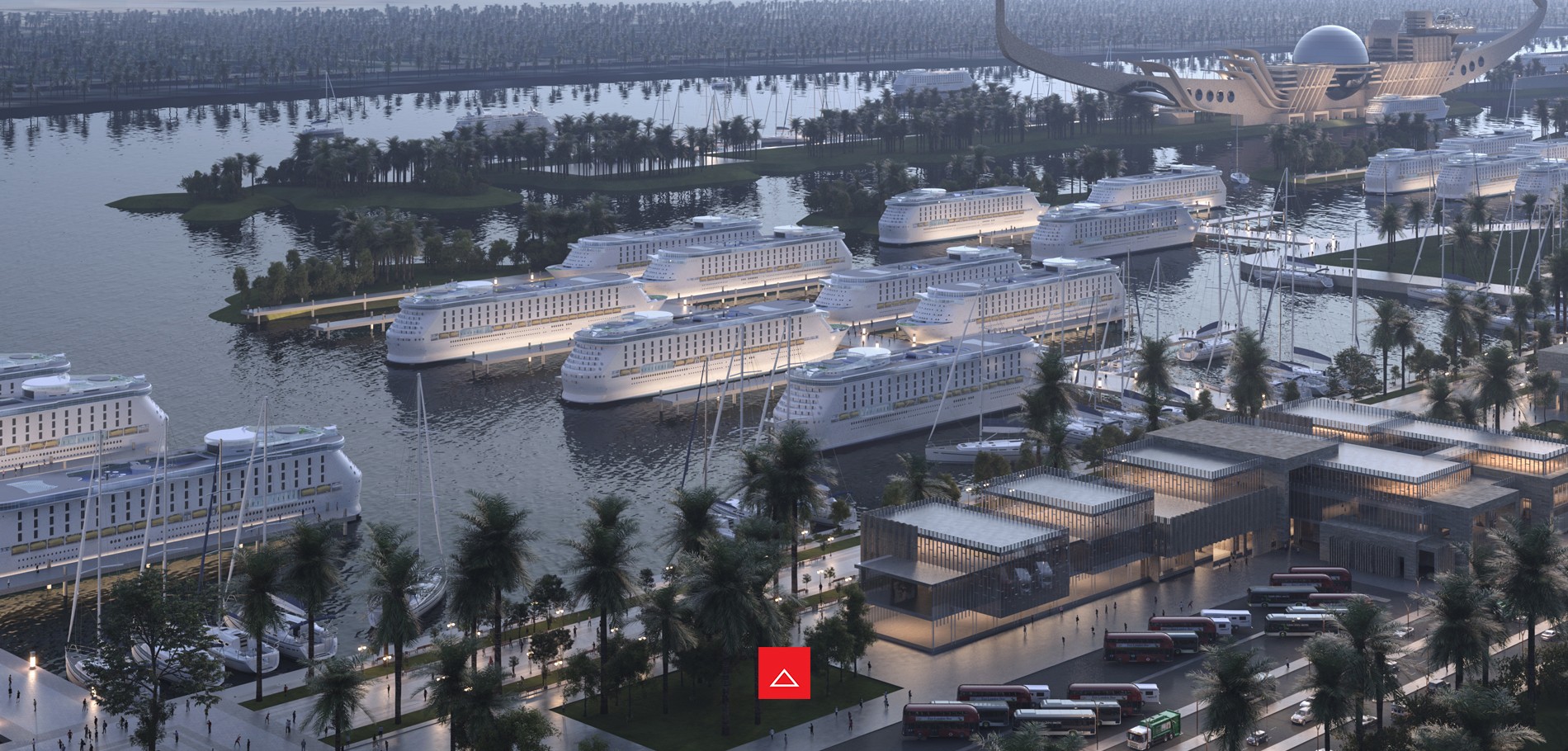
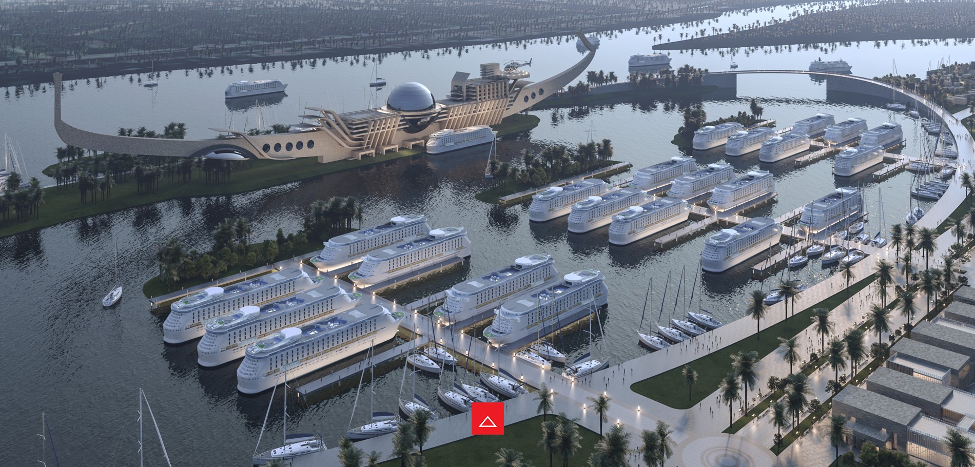
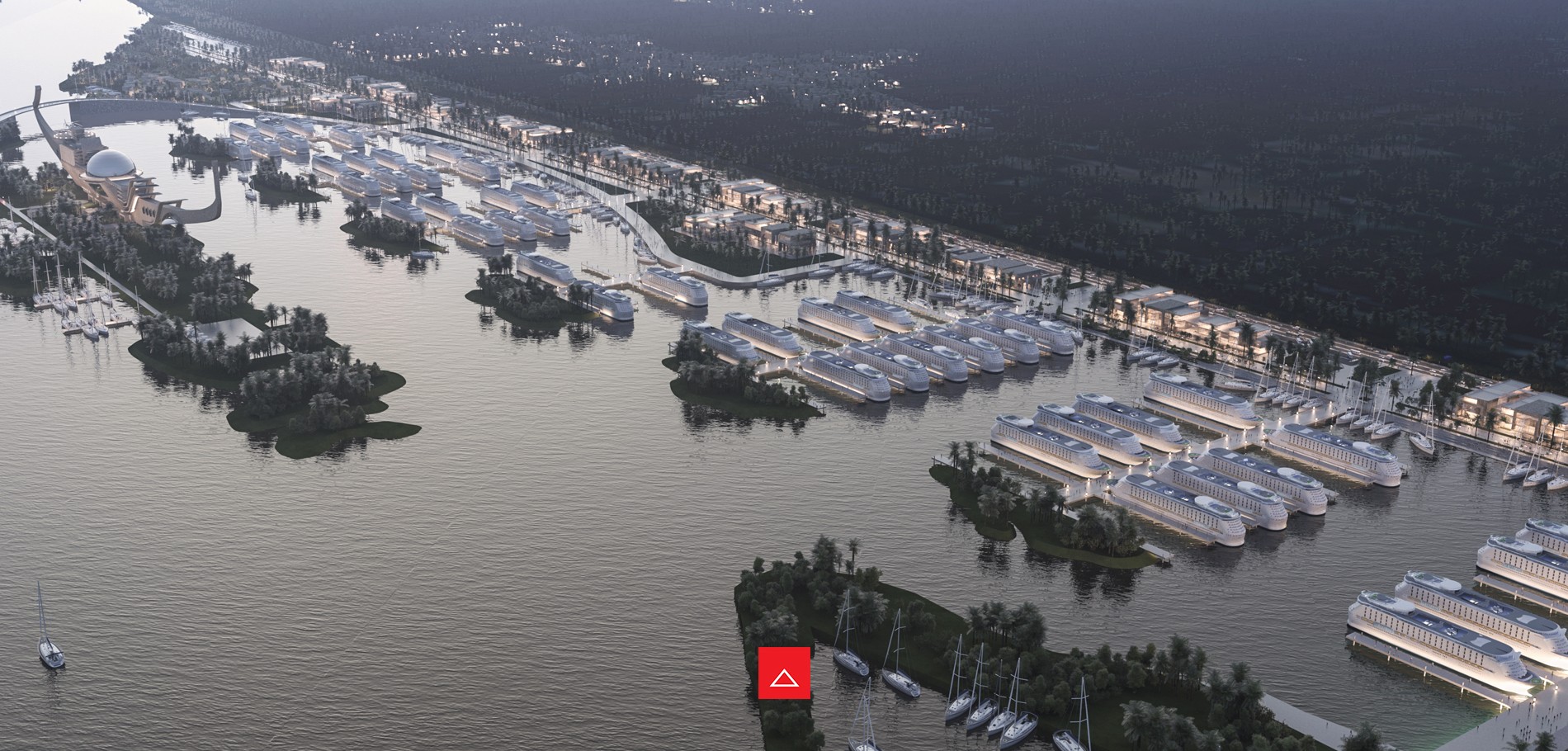
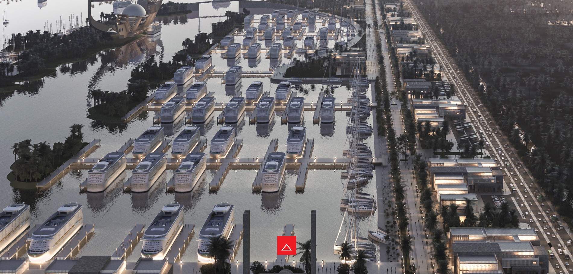
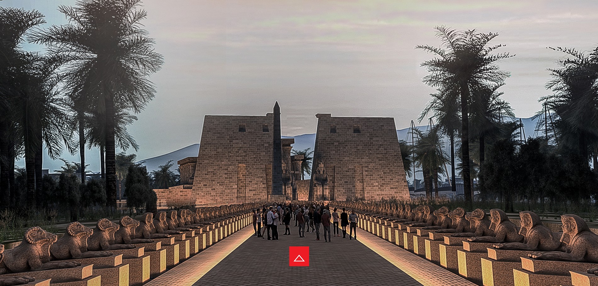
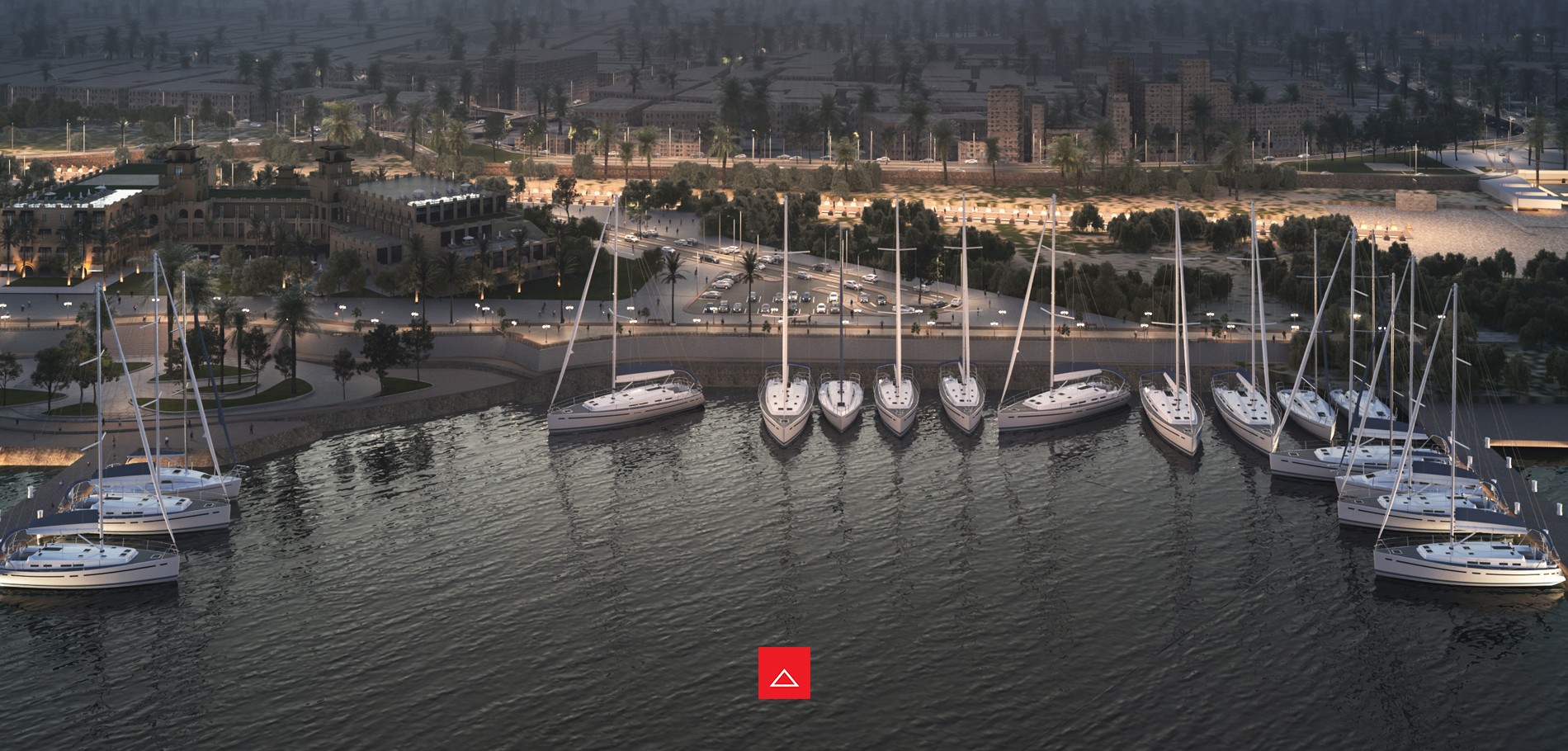
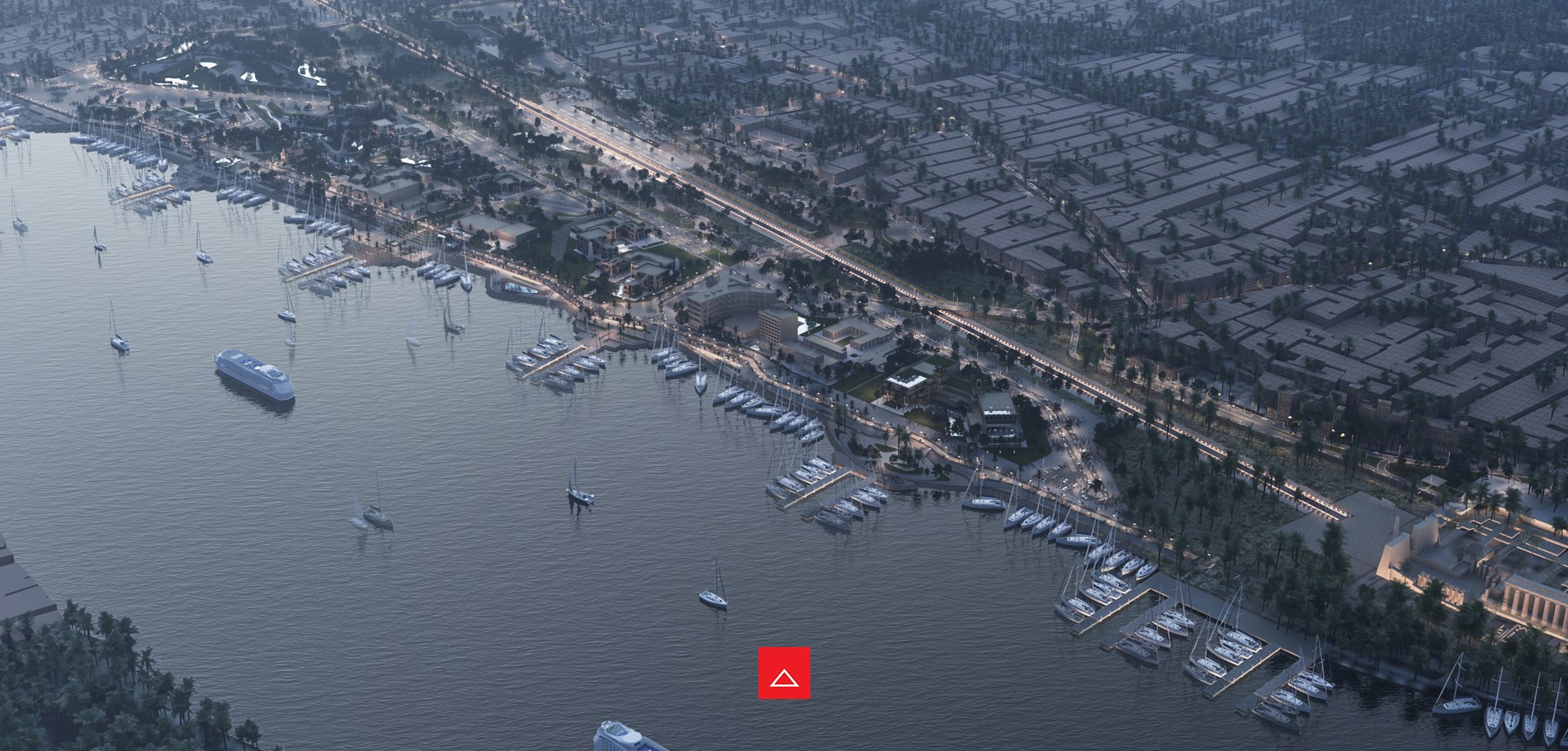
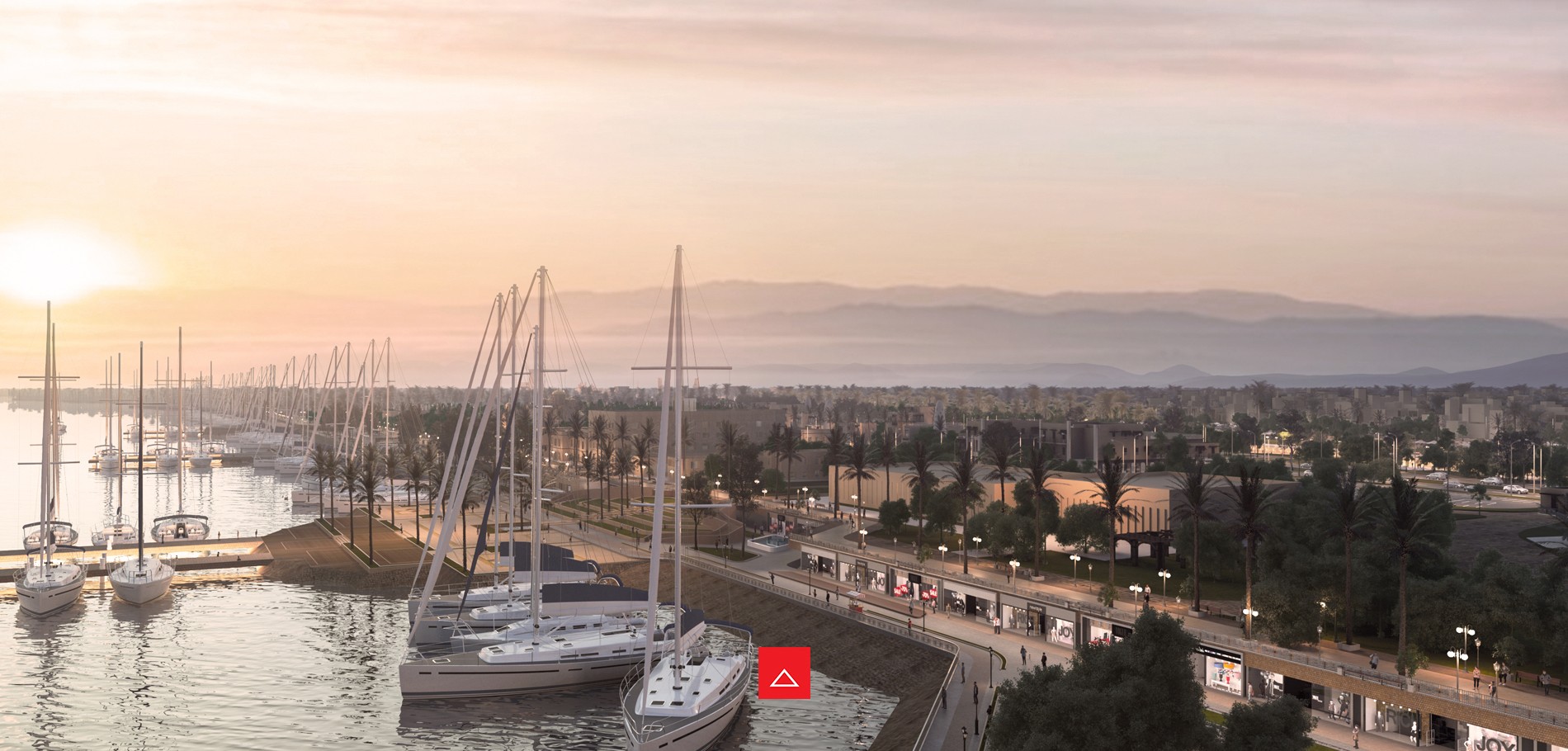
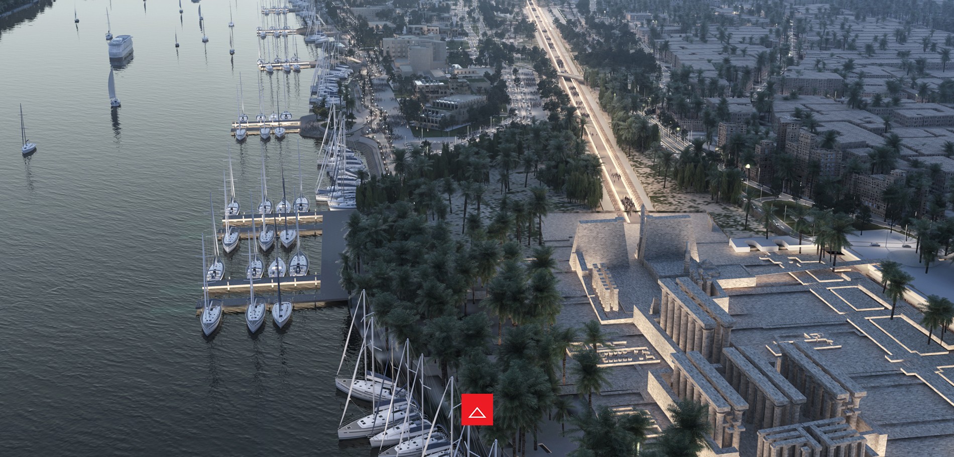
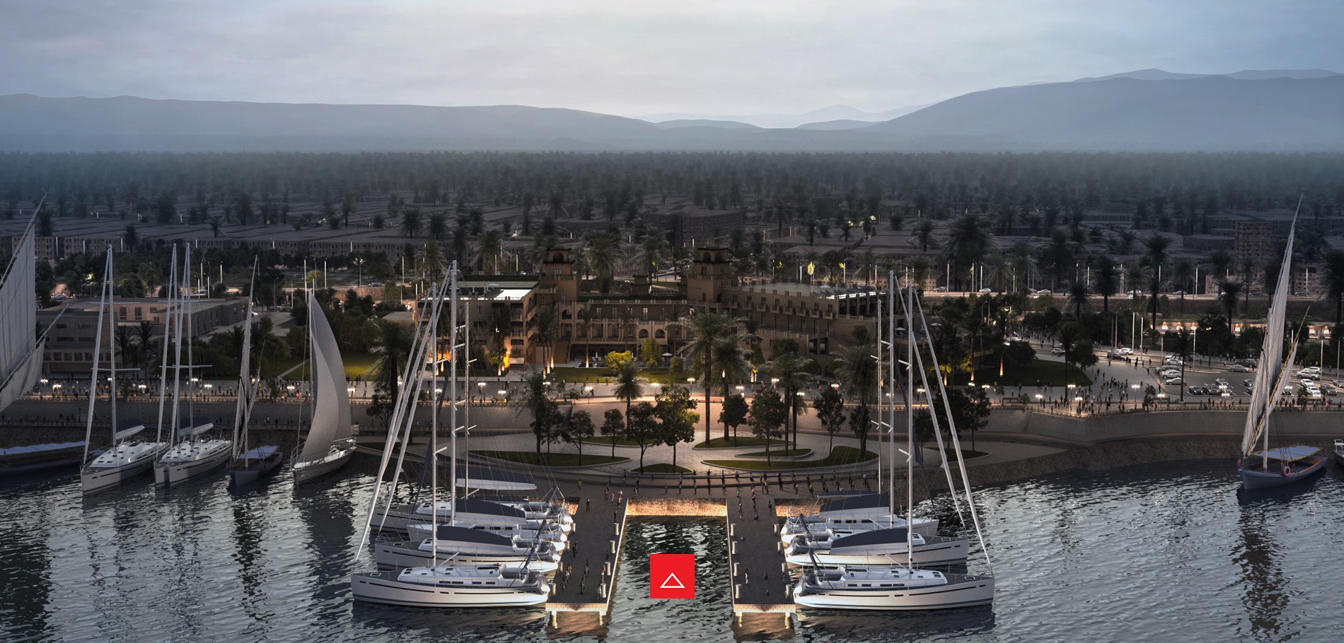
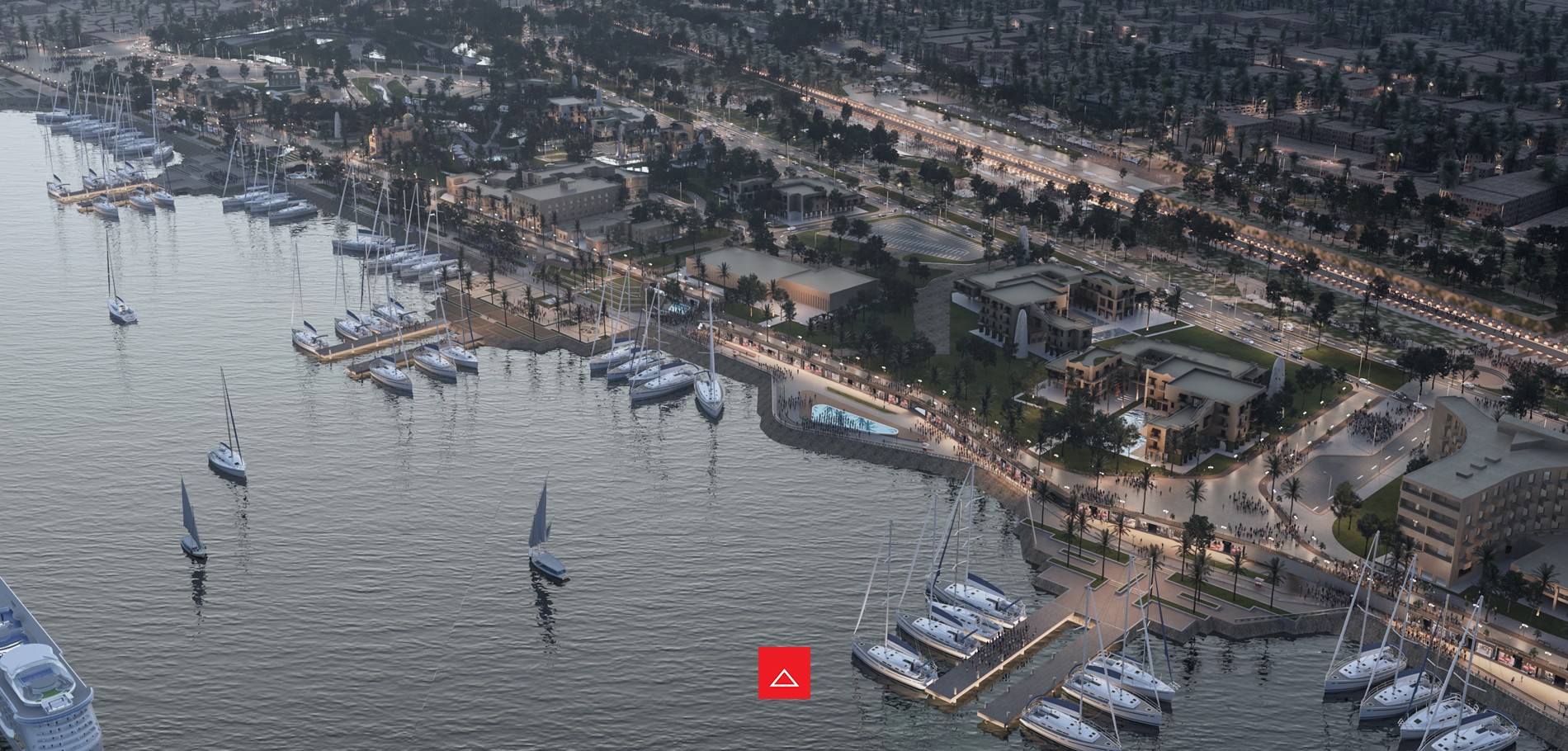
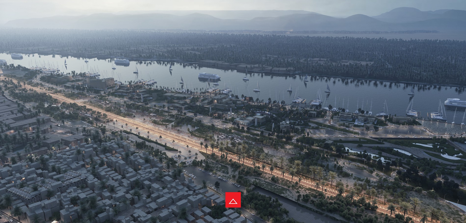
Sphinx Avenue is situated on the east bank of the Nile river and is the junction between Luxor and Karnak temple. The 2,700 -meter long infrastructure is one of the oldest of its kind. It was annually used during the Opet Festivals, where Ancient Egyptians joyously paraded along the road while escorting the statues of Amun and Mut as an allegorical representation of their marriage. Unfortunately, over the years, this iconic road has been completely neglected and has led to the construction of many unplanned urban settlements in the area. Golden Triangle’s main objective is to preserve the area’s historical legacy and heritage by relocating the buildings and providing the area with major tourist attractions and hospitality services in order to utilize the historical land. In addition, the project aims to lower the corniche to be at ground level with sphinx avenue in order to provide an undisturbed view of the Nile and form a connection between the two.


Three main pedestrian axes were emphasized:

–Axis one (East): Market Street, life in the old city
–Axis two (Middle): Sphinxes Avenue, history as a backbone
–Axis three (West): Cornice Path, the main walkway on the bank of the Nile, including any services a visitor might need.

Visit Tutera’s blog to learn more about the upcoming projects

https://cubeconsultants.org/tutera/

THE LOCATION

LUXOR CITY:

Luxor, probably the most interesting destination in Egypt. In this city, the former Thebes, some of the biggest and best preserved temples of the ancient times can be visited.

“Luxor is a city in Upper (southern) Egypt and the capital of Luxor Governorate. Luxor has frequently been characterized as the “world’s greatest open air museum”, as the ruins of the temple complexes at Karnak and Luxor stand within the modern city. Immediately opposite, across the Nile River, lie the monuments, temples and tombs on the West Bank Necropolis, which include the Valley of the Kings and Valley of the Queens. Thousands of international tourists arrive annually to visit these monuments, contributing a large part towards the economy for the modern city.

ABOUT THE PROJECT:

This project falls within the strategic plan for the city of Luxor which aims to transform the city of Luxor to open museum. Well as several others targets such as the regulation of construction activities in general, development the level of residential areas and the provision of all types of services required with the re-investment the potentials for both city tourism impacts, and natural areas.

LOCATION OF THE PROJECT:

The project site is roughly rectangular in its shape, Luxor Museum is the southern boundary of the site, the Museum of Karnack is the northern boundary of the site, and Nile River is the limit of the West, the eastern limit is the ancient city.

This region called the Golden Triangle area because of its great importance also it contains a lot of potential.


EXISTING SITE ANALYSIS:

Site Problems

  • Lack of distinct cultural coordination of the Cornice.
  • Deficiency in manipulating the Nile interface and misusing the site’s possessions.
  • Not taking advantage of the confined area between the Luxor and Karnak temples for tourism and abandoning it historical value in this area.


Site Potentials:

  • Ability to develop the Nile Cornish area, in addition of establishing activities compatible with the remarkable ancient nature of the place.
  • A remarkable economical area with its specialized position between Luxor and Karnak temples and having a Nile interface view.
  • Revealing the Nile water front of Luxor
  • Making use of the Avenue of Sphinx as a linking way between Luxor and Karnak
  • Location of Luxor and Karnak temples as one of the most important monuments in the world heritage.

Master Plan done in 2009

LUXOR NILE CRUISES MARINE

INFO & SUMMARY

Info

Total Area: 500 FD

Location: Luxor, Egypt

City: Luxor

Year: 2009

Themes: Transportation, Entertainment

Location: 

Luxor Marine is located along with the Sun Ship, a stable boat that is designed to resemble the ritual vessel that carried Khufu’s resurrected body across the heavens to the Sun God, Ra. Each terminal will accommodate tourists in the utmost luxury with entertainment, leisure as well as numerous retail offerings. 

Current situation: 

Luxor, a city in Upper Egypt, is reputed to be the “world’s greatest open-air museum.” Thousands of tourists travel overseas to glance at the historical monuments, buildings, and tombs. Located across the iconic Luxor temple, the Nile cruise offers tourists the experience of unfolding thousands of historical years through a memorable journey. It is one of Luxor’s most popular tourist attractions and greatly contributes to the economic growth of the city.  Unfortunately, the marina has been completely neglected which caused many ships to be left to sink or burn as a form of disposal. This reckless action results in severe damage to the marine ecosystem killing marine life and impacting worldwide economic structures.

Main goal:

“ Luxor Marine” aims to reconstruct the marinas parking area in a way that would be more structured and less damaging to the environment. The project will not only consist of a more organized anchorage area for cruise ships and sailboats but will also include numerous services such as dockyards, hospitals, fire and police stations, as well as travel agencies.

Visuals updated 2020

Visit Tutera’s blog to learn more about the upcoming projects

https://cubeconsultants.org/tutera/

THE LOCATION

CURRENT SITUATION

THE MASTERPLAN AND STUDIES